4C Offshore (part of TGS) is a global leader in market intelligence and consultancy for offshore renewable energy, particularly offshore wind and subsea power cables. Delivering data‑driven insights, comprehensive datasets, interactive tools, and expert support across the full lifecycle of offshore wind projects and submarine cable ventures to empower developers, investors, supply chains, and governments worldwide.
Offshore wind projects demand highly specialised spatial analysis that standard GIS software does not always provide out-of-the-box. To bridge this gap, custom GIS Plugin have been developed in ArcGIS that directly address the needs of offshore wind consultants, engineers, and analysts.
For example, in an offshore wind farm like Hornsea One, the world’s largest operational offshore wind farm, decision-makers would have needed to make quick, reliable answers to questions about turbine performance, energy yield, and site suitability when developing the project. The GIS Plugin delivers these insights through six key modules:
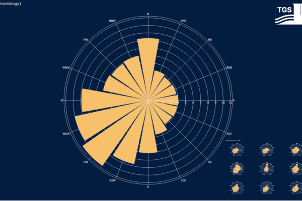
- WindRose: Generates clear visualisations of prevailing wind direction and frequency, essential for turbine siting and wake effect assessment. We can either see an Average wind direction or we can break it down into Monthly Averages.
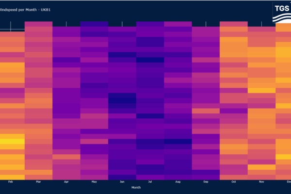
- Windspeeds: Retrieves and plots average windspeeds at hub heights. For Hornsea One we have hub heights of around 113m so the height that we can recommend to look at would be 107m.
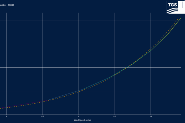
- WindShear: Analyses how wind speeds change with height, providing a basis for extrapolating with real time wind conditions to different turbine designs.
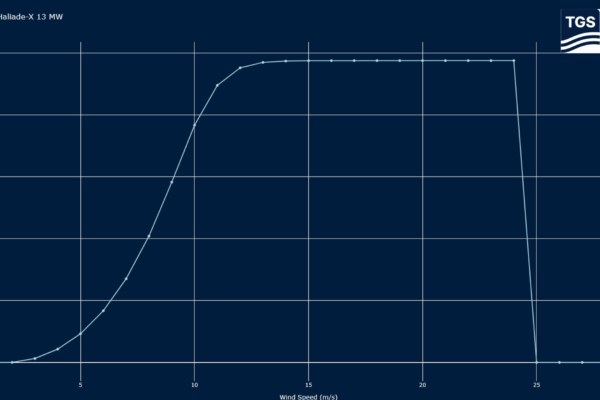
- PowerCurve: Connects turbine specifications with wind data to model output at varying wind speeds, bridging meteorological data with engineering performance.
- AEP (Annual Energy Production): Calculates long-term energy yield, a critical metric for investment appraisal and financial modelling. With added features like comparing AEP of windfarms.
- WaterDepths: Maps and classifies bathymetric conditions, helping identify suitable turbine foundation types and highlighting areas of construction challenge.
Each tool addresses a core aspect of offshore wind development. When combined, they provide a steam lined workflow from characterising the wind resource to modelling turbine performance and assessing site conditions. Instead of running disconnected analyses or sourcing data manually, the GIS Plugin allows users to complete these steps rapidly and consistently inside GIS.
APIs further enhance this workflow by ensuring that the data feeding these tools is live and standardised. Whether it is updated climatological wind data, turbine specifications, or site conditions, APIs reduce manual processing and provide confidence that analyses reflect the latest information. This is particularly valuable in fast-moving projects like Hornsea One, where results need to be defensible and reproducible across large teams and stakeholders.
The result is not just speed, but reliability. By embedding offshore wind–specific tools in GIS, analysts can focus on interpretation and decision-making rather than repetitive data handling. For developers, regulators, and investors, this means faster insights, more transparent assumptions, and stronger confidence in outcomes.
As offshore wind scales up globally, the need for specialised GIS tools will only increase. GIS Plugin like these integrated with live data through APIs ensure that GIS remains central to delivering efficient, evidence-based decisions for projects like Hornsea One and beyond.


